
Welcome to the world of California mapping! In this article, I’ll introduce you to the diverse mapping solutions, technologies, and services available in the Golden State. Whether you’re interested in exploring California’s geology, history, topography, or geographic data, there’s a mapping solution that will provide you with valuable insights.
The California Geological Survey (CGS) is the go-to resource for scientific products and services related to the state’s geology, seismology, and mineral resources. They offer a wide range of mapping solutions, including geologic maps, mineral resource mapping, and geologic hazards identification. These detailed maps are essential tools for understanding the state’s geology, evaluating potential hazards, and identifying valuable mineral resource zones. The CGS also provides interactive web maps and a data viewer, making their mapping data easily accessible to anyone interested in exploring California’s geological wonders.
Key Takeaways:
- California Geological Survey (CGS) provides comprehensive mapping solutions for geology, seismology, and mineral resources.
- Geologic maps, mineral resource mapping, and geologic hazards identification are among the mapping services offered by CGS.
- Interactive web maps and a data viewer make CGS mapping data easily accessible.
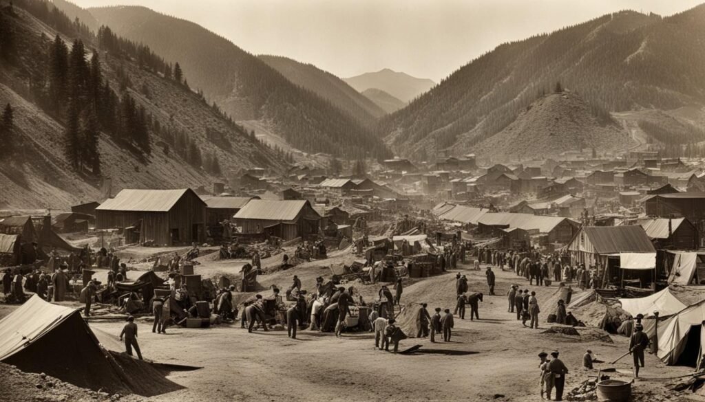
Mapping California’s History: Old and Historical Maps
Exploring the history of California through mapping can provide fascinating insights into how the state has evolved over time. One way to delve into the past is by studying old and historical maps of California. These maps offer a visual representation of the state’s development, including changes in cities, geography, and cultural landscapes.
Old maps of California can be found in archives and historical collections, offering a glimpse into the past through the lens of cartography. These maps provide valuable information on early settlements, the expansion of industries, and the transformation of land use. By examining these historical maps, we gain a deeper understanding of California’s rich heritage and the factors that have shaped the state we know today.
- Early maps of California can reveal the explorations of Spanish and European settlers, showcasing their discoveries and the territories they claimed.
- Historical maps of California can illustrate the growth of cities, such as San Francisco, Los Angeles, and San Diego, highlighting the development of urban centers over time.
- California history maps can also display the changing boundaries of the state, reflecting the impact of political and territorial shifts throughout history.
Through the art of cartography, these old and historical maps take us on a journey through time, providing a unique perspective on California’s past. They help us appreciate the legacy of those who came before us, and the significant events and influences that have shaped the state’s identity.
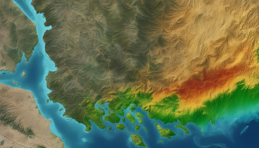
Mapping California’s Topography: Topographical and 3D Mapping
To better understand California’s topography, we employ topographical mapping and 3D mapping techniques. These mapping methods provide detailed information about the elevation, terrain, and physical features of the state, allowing us to create accurate representations of California’s topography. By utilizing satellite mapping and digital mapping technologies, we are able to capture the intricate details of the state’s diverse landscapes.
Topographical mapping is an essential tool for analyzing the surface characteristics of California. It involves the measurement and representation of the elevation and relief of the land through the use of contour lines. These lines connect points of equal elevation, enabling us to visualize the varying heights and slopes across the state.
3D mapping takes the visualization of California’s topography to the next level. Through advanced techniques and technologies, we create three-dimensional models that provide a realistic representation of the state’s physical features. These models allow for a more immersive and interactive exploration of California’s topography.

As technology continues to advance, digital mapping has become increasingly prevalent in the field of cartography. Digital mapping tools and software enable us to process and analyze the vast amounts of geographic data available, allowing for the creation of accurate and detailed topographic maps. Additionally, Geographic Information System (GIS) mapping software plays a crucial role in managing and visualizing the geospatial data used in topographical mapping.
By combining topographical mapping, 3D mapping, satellite mapping, and digital mapping technologies, we gain a comprehensive understanding of California’s topography. This knowledge is not only valuable for scientific research and land management but also for various industries such as urban planning, environmental assessment, and infrastructure development.
California’s diverse topography is a testament to its geographical richness, and through the use of innovative mapping techniques and technologies, we can unlock the secrets hidden within its landscapes.
California Mapping Services: GIS and Spatial Data Analysis
In California, there are a variety of mapping services available to support GIS mapping and spatial data analysis. These services are essential for organizations and individuals looking to gain insights and make informed decisions using geospatial data.
GIS mapping, or Geographic Information System mapping, is a powerful tool that allows users to visualize and analyze spatial data. It combines data from various sources, such as satellite imagery, aerial photography, and geographic databases, to create comprehensive and interactive maps.
GIS mapping in California enables users to explore different layers of data, such as population distribution, land use, transportation networks, and environmental factors.
By utilizing mapping services in California, you can access a wide range of geospatial data, including aerial imagery, topographic maps, parcel boundaries, and demographic information. These datasets are crucial for conducting detailed analyses, identifying trends and patterns, and understanding spatial relationships.
GIS mapping and spatial data analysis are invaluable in numerous fields, such as urban planning, resource management, emergency services, and environmental assessment. Whether you need to identify optimal locations for new infrastructure projects or assess the impact of a proposed development on the surrounding area, mapping services in California provide the necessary tools and data.
Mapping services also offer the flexibility to customize maps according to specific needs. You can choose different map layers, add labels or annotations, and apply various analytical tools to extract meaningful insights. This level of customization empowers users to communicate complex spatial information effectively and make evidence-based decisions.
Overall, mapping services in California play an integral role in GIS mapping and spatial data analysis. They provide the necessary tools, data, and expertise to make informed decisions, understand spatial relationships, and unlock valuable insights.
Mapping California’s Geographic Data: The Role of Cartography
When it comes to mapping California’s geographic data, cartography plays a vital role. It involves the creation, interpretation, and analysis of maps that accurately represent the physical and human features of the state. Cartographers rely on various geographic data sources, such as topographic information, land use data, and demographic data, to create informative maps that provide valuable insights into California’s diverse landscapes.
These maps are not only aesthetically pleasing but also serve as crucial tools for a wide range of applications. For example, in urban planning, cartographic maps help city planners visualize and understand the spatial distribution of different land-use types, population densities, and transportation networks. This allows for informed decision-making and efficient resource allocation.
Moreover, cartography plays a significant role in natural resource management. By accurately mapping California’s geospatial data, cartographers enable resource managers to identify and monitor areas of ecological importance, such as forests, wetlands, and protected habitats. These maps assist in the conservation and preservation of California’s unique ecosystems.
Another vital application of cartography is in emergency response. During natural disasters like wildfires or earthquakes, timely and accurate maps are crucial for emergency responders to assess affected areas, plan evacuation routes, and coordinate rescue efforts. Cartographic maps provide essential information about topography, transportation networks, and infrastructure, helping responders make informed decisions and save lives.
With the advancements in mapping technology and the availability of high-quality geographic data, cartography in California has become even more precise and detailed. Sophisticated Geographic Information System (GIS) software enables cartographers to analyze and visualize large-scale datasets, further enhancing the accuracy and usefulness of the maps produced.
Overall, cartography holds a prominent place in mapping California’s geographic data. Through the creative and skillful interpretation of various data sources, cartographers provide valuable insights into the state’s physical and human characteristics. These maps serve as invaluable tools for urban planners, resource managers, emergency responders, and many others who rely on accurate geospatial information to make informed decisions and optimize their operations.
- Accurate representation of California’s physical and human features
- Essential for urban planning, natural resource management, and emergency response
- Enables visualization and understanding of spatial distribution
- Assists in conservation and preservation of unique ecosystems
- Critical for assessing affected areas and coordinating rescue efforts during emergencies
- Advancements in GIS technology enhance map accuracy and usefulness
Mapping Solutions in California: Software and Technology
The availability of mapping software and technology has revolutionized the way mapping is done in California. From professional mapping companies to individual users, there are various software tools and technologies available that enable the creation, analysis, and visualization of maps. These mapping solutions range from user-friendly applications to advanced GIS software, providing users with the ability to explore and interpret geographic data in innovative ways.
When it comes to mapping software in California, there is no shortage of options. Companies like Esri, a leading provider of mapping technology, offer powerful software solutions that cater to a wide range of industries. Their ArcGIS platform provides users with the tools to create interactive maps, perform sophisticated spatial analysis, and share their findings with others.
In addition to professional software, there are also user-friendly applications available for individuals who want to create their own maps. Tools like Google Maps and MapQuest allow users to easily find locations, get directions, and even create custom maps with markers and annotations.
One of the key advantages of mapping technology is its ability to integrate various data sources, such as satellite imagery, aerial photography, and geospatial datasets. This allows users to create comprehensive maps that provide detailed information about the features and characteristics of a specific area.
Mapping technology also supports spatial data analysis, enabling users to uncover patterns, trends, and relationships within the data. By visualizing information on a map, researchers, government agencies, and businesses can gain valuable insights into population distribution, infrastructure planning, environmental impact assessment, and more.
Whether you’re a professional cartographer or an amateur map enthusiast, mapping software and technology provide powerful tools for exploring California’s diverse landscapes and resources. With the ability to create, analyze, and visualize geographic data, these mapping solutions empower users to make informed decisions and discover new perspectives on the Golden State.
Conclusion
California mapping solutions offer a wealth of insights into the state’s geology, history, and geography. With detailed maps, advanced mapping technologies, and geospatial analysis, individuals and organizations can explore and understand the diverse landscapes and resources of California.
Studying old maps provides a fascinating glimpse into the state’s history, allowing researchers to track the development of cities, changes in geography, and cultural shifts over time. On the other hand, modern mapping software empowers users to analyze and interpret spatial data for in-depth data analysis and visualization.
As technology continues to advance, the future of mapping in California looks promising. With ongoing innovations in mapping technology, there will be even more accurate and informative insights into the state’s dynamic features, from its topography to its cultural heritage. California mapping services have become indispensable tools for understanding the state and harnessing its potential.
FAQ
What services does the California Geological Survey (CGS) provide?
The CGS offers various mapping solutions, including geologic maps, mineral resource mapping, and geologic hazards identification. They also provide interactive web maps and a data viewer for easy access to their mapping data.
Where can I find old and historical maps of California?
Many old and historical maps of California can be found in archives and historical collections, offering a glimpse into the state’s past through cartography.
What is topographical mapping and 3D mapping?
Topographical mapping and 3D mapping techniques provide detailed information about the elevation, terrain, and physical features of California. Satellite mapping and digital mapping technologies are also used to create accurate representations of the state’s topography.
What mapping services are available in California?
California offers various mapping services for GIS mapping and spatial data analysis. These services provide access to geospatial data, allowing organizations and individuals to perform detailed analyses and create custom maps.
How does cartography contribute to mapping California’s geographic data?
Cartography plays a vital role in mapping California’s geographic data by using land use data, demographic data, and topographic information to create accurate and informative maps for applications such as urban planning, natural resource management, and emergency response.
What technologies are used for mapping in California?
Mapping in California utilizes a range of software tools and technologies, including mapping software and advanced GIS software, which enable the creation, analysis, and visualization of maps for various purposes.